Monday, December 27, 2010

Cross County Trail


Cross county trail..name says it all. Long stretch of trail which touches almost every corner on beautiful Fairfax county. It's an another awesome trail on Gerogetown Pike just after Great Falls intersection while driving towards I-495 junction. One can start this trail from Difficult run trail parking lot on GTN Pike or from Great Falls end which again cut thru' the Difficult run trail parking lot while climbing down. Unlike Scott trail, CC trail mostly run thru' flat surface atleast upto an intersection of route 7.


The water stream intersects the trail in two places. It's indeed a panoramic view to watch the bending trail by standing on the neatly placed stones in middle of the water flow. Strategic location of this trail makes life easier for bikers as it can be easily accessed from multiple points, however one has to watch out the water flow on the stream. Not sure how fast the current would be on winter/rainy season.


On the day of our hike, Group of people from Hash House Harriers were running all across the trail, playing and finding the lost routes :-). It was so much fun to watch them as they were looking cool & enjoying their every bit of moment on the stretches of the trail. While we were shivering with low temperature, this group was running without any jackets. Interestingly the group was active even when we were returning to our base.


Compared to Scotts run trail CC seems to be little easier as it does not have much of slopes. However the length of the trail makes a life little tough for newbies. Anyone looking for moderately lengthy trail with easy access to connecting roads, this one would be the perfect bet for them.
Tuesday, December 14, 2010

Scott's Run Trail


Scott's run trail is one of my favourite hike place on Gerogetown Pike. It's Geographical location gives many advantage over other trails. Most of the trails will be either far away from my place or may not have perfect blend of what Scott's run trail has it. It's close proximity to city limits paves a way to people to drive in here. It's a perfect trail for starters who would like to have some kind of warm up before gearing up for big hikes, ofcourse one has to try all the loops on this trail for couple of times :-) It's an easy hike with relatively small distance on each loop. However there's lot of natural slopes scattered thru' out the path.


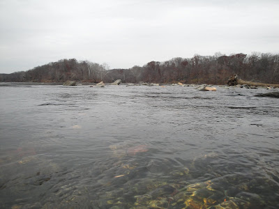
While one side of the trail slope covered with long and dense trees, the other side touches the feet of silent looking Potomac river. It's a splendid view when you descend towards the river. If observed closely and consciously, the calmness of the whole trail disappears slowly and get replaced with the sound of falling waters while approaching near to the banks of Potomac. If you guessed it, you are almost right. There's a small water falls on the bottom edge of the slope trail.


On top of the falls water flows thru' the flat surface before hitting the rockies. Water flow picks up the speed when it passes thru' the sneaky rocks on the top edge of the falls. On the bottom of the falls, naturally placed rocks form a scenic water pond. Overflowing water from this small pool constantly running towards the river thru' the small delta region before merge with Potomac. There's not much currents on the entire river on this region but the flow was continuing at good speed. Monsoon season would be a great choice to feel the beauty of this small falls and the river currents.


There's a small abandoned fire place on the top edge of the slope. Here the trail split into two, with the outer one goes to another end of parking place on Gerogetown Pike and the inner loop crosses both the parking places on the pike. Overall its a nice place to warm up and refresh. Anyone looking for nice scenic place with river facing rocks to sit down quitely, this is the place for you.